


Voting District 54395, Contra Costa County, California
About
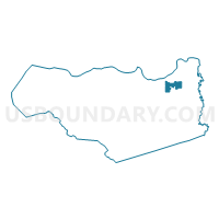
Outline

Summary
| Unique Area Identifier | 529722 |
| Name | Voting District 54395 |
| County | Contra Costa County |
| State | California |
| Area (square miles) | 5.97 |
| Land Area (square miles) | 5.81 |
| Water Area (square miles) | 0.17 |
| % of Land Area | 97.23 |
| % of Water Area | 2.77 |
| Latitude of the Internal Point | 37.99779500 |
| Longtitude of the Internal Point | -121.70115900 |
Maps


Graphs
Select a template below for downloading or customizing gragh for Voting District 54395, Contra Costa County, California


Neighbors
Neighoring Voting District (by Name) Neighboring Voting District on the Map
- Voting District 31860, Contra Costa County, CA
- Voting District 32465, Contra Costa County, CA
- Voting District 54375, Contra Costa County, CA
- Voting District 54380, Contra Costa County, CA
- Voting District 54385, Contra Costa County, CA
- Voting District 54390, Contra Costa County, CA
- Voting District 54400, Contra Costa County, CA
- Voting District 54430, Contra Costa County, CA
- Voting District 54440, Contra Costa County, CA
- Voting District 54450, Contra Costa County, CA
- Voting District 54460, Contra Costa County, CA
Top 10 Neighboring County Subdivision (by Population) Neighboring County Subdivision on the Map
Top 10 Neighboring Place (by Population) Neighboring Place on the Map
Top 10 Neighboring Elementary School District (by Population) Neighboring Elementary School District on the Map
- Brentwood Union Elementary School District, CA (54,635)
- Oakley Union Elementary School District, CA (33,213)
Top 10 Neighboring Secondary School District (by Population) Neighboring Secondary School District on the Map
Top 10 Neighboring Unified School District (by Population) Neighboring Unified School District on the Map
Top 10 Neighboring State Legislative District Lower Chamber (by Population) Neighboring State Legislative District Lower Chamber on the Map
Top 10 Neighboring State Legislative District Upper Chamber (by Population) Neighboring State Legislative District Upper Chamber on the Map
Top 10 Neighboring 111th Congressional District (by Population) Neighboring 111th Congressional District on the Map
Top 10 Neighboring Census Tract (by Population) Neighboring Census Tract on the Map
- Census Tract 3020.10, Contra Costa County, CA (10,039)
- Census Tract 3020.08, Contra Costa County, CA (7,718)
- Census Tract 3020.05, Contra Costa County, CA (6,592)
- Census Tract 3020.07, Contra Costa County, CA (6,347)
- Census Tract 3020.06, Contra Costa County, CA (3,779)
- Census Tract 3010, Contra Costa County, CA (3,659)